BMR.6.8.237 (Transparency colour)

BMR.6.8.237 (Transparency colour)
Hugh E. Richardson
Hugh Richardson
1936-50
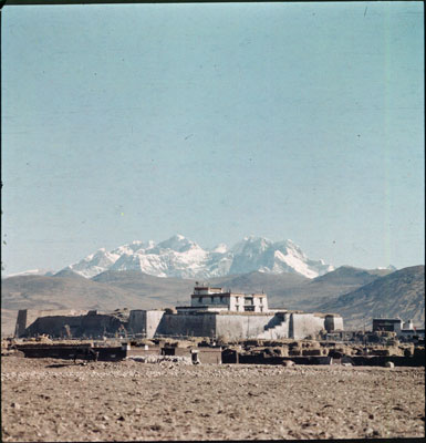
Chumbi Valley Region > Phari
BMR.6.8.237
60 x 90 mm
Transparency Colour
Hugh E. Richardson
Technical Information - The cameras used to take this collection of colour slides (Dufay colour) were a Zeiss Super Ikonta and a Reflex Korelle. [KC 09/10/2006]
Manual Catalogues - Typewritten handlist entitled 'Hugh Richardson Collection, The British Museum. Photographs taken between 1936-50. Cameras: Zeiss Super Ikonta, Reflex Korelle. 300 colour slides (Dufay colour); copies made Jan. 1995.
[no.] 237. Phari Dzong .' [KC 11/10/2006]
Other Information - Setting: Pha ri (phag ri) is situated at 4360 m and is one of the highest settlements in the world. The town served as a major trading centre between Tibet, Bhutan and Sikkim. It also served as the main administration centre for Western Tibet. It is surrounded by major Himalayan peaks, in the east Chomolhari is visible and in the west lies the Kunchenjunga range. (TS)
For Citation use:
The Tibet Album.
"Phari Dzong and Chomolhari range in the background"
05 Dec. 2006. The British Museum.
<http://tibet.prm.ox.ac.uk/photo_BMR.6.8.237.html>.
For more information about photographic usage or to order prints, please visit the The British Museum.
© The British Museum